Skip to main content
Advanced Search
Narratives
Background to the McKenna McBride Royal Commission
Impacts of the McKenna McBride Commission
Our Culture Lives in the Land
Testimonies
Maps/Photos
Final Report
Agency Reports
Additional Resources
My Account
My bookmarks
Register
Log in
About
For Teachers
For Researchers
About the Records
About the Project
Disclaimers and Copyright
FAQs
How to Use
Advanced Search
Our Homes Are Bleeding
Digital Collection
Return to Library & Archives
Items
View as:
Grid
List
Created
Resource class
Title
Contributed on (numeric:timestamp)
Created on (numeric:timestamp)
Date (numeric:integer)
Date (numeric:interval)
Date (numeric:timestamp)
Date Created (numeric:timestamp)
Date Modified (numeric:timestamp)
Ascending
Descending
Sort
Advanced search
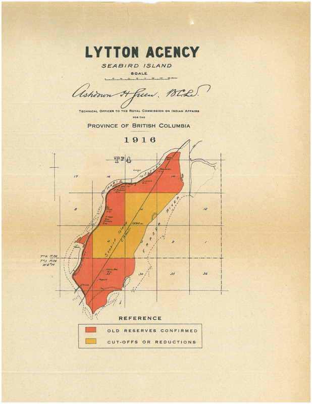
Lytton Final Report Images/Lytton Images du rapport final - Seabird Island - Full Map Image/Image complète du carte
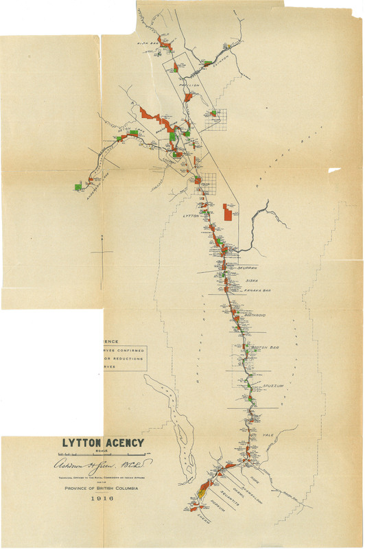
Lytton Final Report Images/Lytton Images du rapport final - Kanaka Bar Band, Boothroyd Band, Boston Bar Band, Spuzzum Band, Yale Band, Hope Band
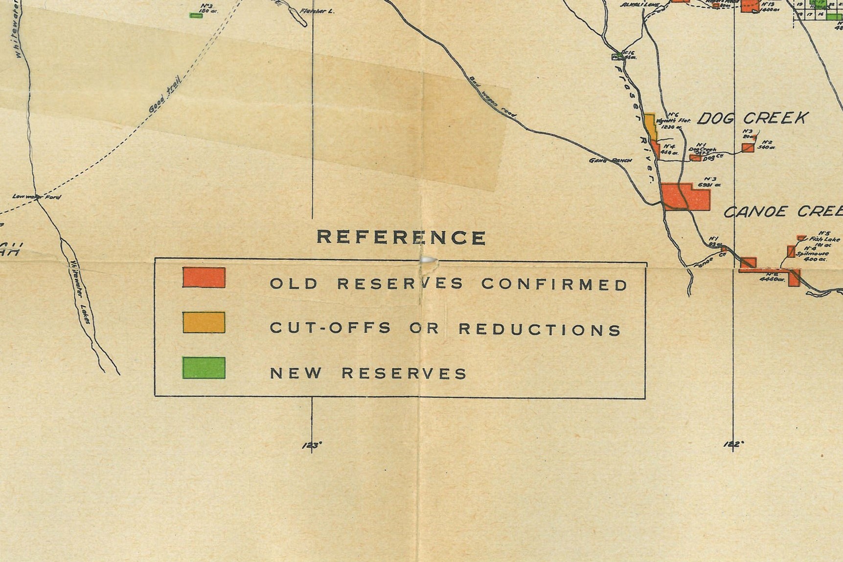
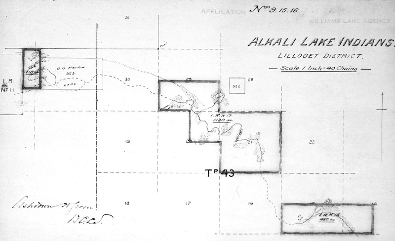
Alkali Lake Indians. Lillooet District. [Map showing Reserves No. 11, 11A, 15 and 17./Carte montrant les réserves nos 11, 11A, 15 et 17.]
Kincolith band. Nass River Indians. [Map showing Tackuan Reserves No. 26 and 26A./Carte montrant les réserves Tackuan nos 26 et 26A.]
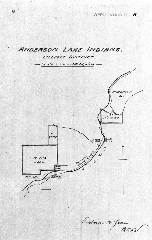
Anderson Lake Indians. Lillooet District. [Map showing Reserves No. 1, 2, 3, 4 and 5./Carte montrant les réserves nos 1, 2, 3, 4 et 5.]
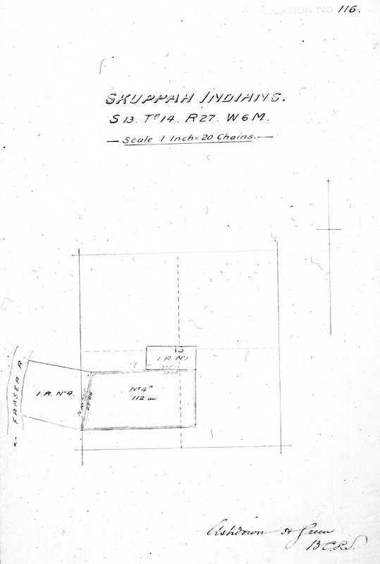
Skuppah Indians. S. 13, Tp. 14, R. 27, W. 6M. [Map showing Reserves No. 1, 4 and 4A./Carte montrant les réserves nos 1, 4 et 4A.]
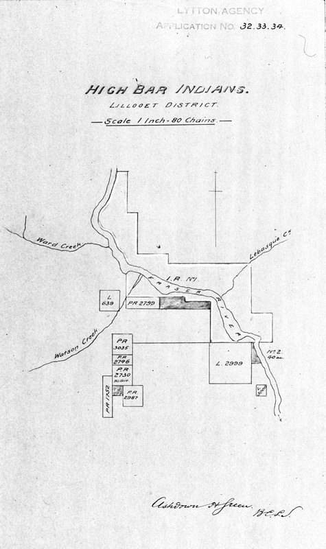
High Bar Indians. Lillooet District. [Map showing High Bar Reserves No. 1, 1A and 2./Carte montrant les réserves High Bar nos 1, 1A et 2.]
Fountain Indians. Lillooet District. [Map showing Reserves No. 1, 1A, 2, 3, 3A, 4, 5, 7, 8, 9, 10, 11 and 12./Carte montrant les réserves nos 1, 1A, 2, 3, 3A, 4, 5, 7, 8, 9, 10, 11 et 12.]
Stone Indians. Lillooet District. [Map showing Brigham Creek reserve No. 3./Carte montrant la réserve Brigham Creek no 3.]
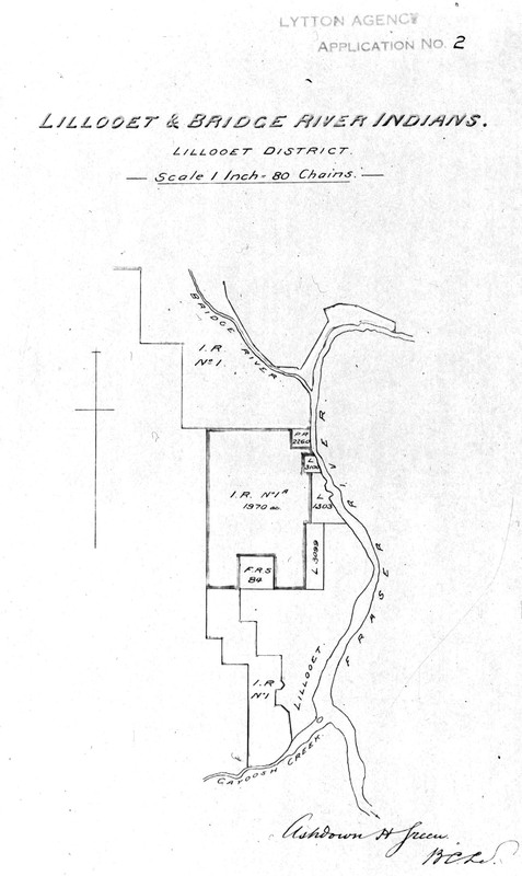
Lillooet & Bridge River Indians. Lillooet District. [Map showing Bridge River Reserve No. 1 and Lillooet Reserves No. 1 and 1A./Carte montrant la réserve Bridge River no 1 et les réserves Lillooet nos 1 et 1A.]
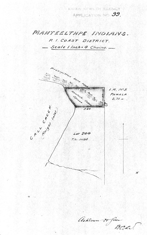
Mahteelthpe Indians. R. 1, Coast District. [Map showing Pawala Reserve No. 5./Carte montrant la réserve Pawala no 5.]
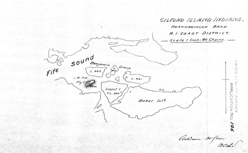
Gilford Island Indians. Kwawwawinuck band. R. 1, Coast District. [Map showing Kukwapa Reserve No. 5./Carte montrant la réserve Kukwapa no 5.]
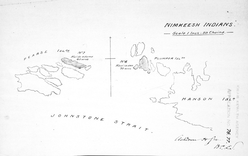
Nimkeesh Indians. [Map showing Ksui-la-das Reserve No. 6 and Kuldekduma Reserve No. 7./Carte montrant la réserve Ksui-la-das no 6 et la réserve Kuldekduma no 7.]
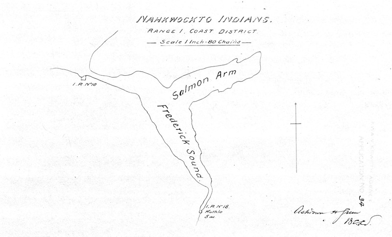
Nahkwockto Indians. Range 1, Coast District. [Map showing Owh-wis-too-a-wan Reserve No. 10 and Kuthlo Reserve No. 18./Carte montrant la réserve Owh-wis-too-a-wan no 10 et la réserve Kuthlo no 18.]
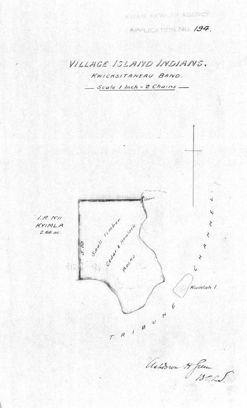
Village Island Indians. Kwicksitaneau band. [Map showing Kyimla Reserve No. 11/Carte montrant la réserve Kyimla no 11.]
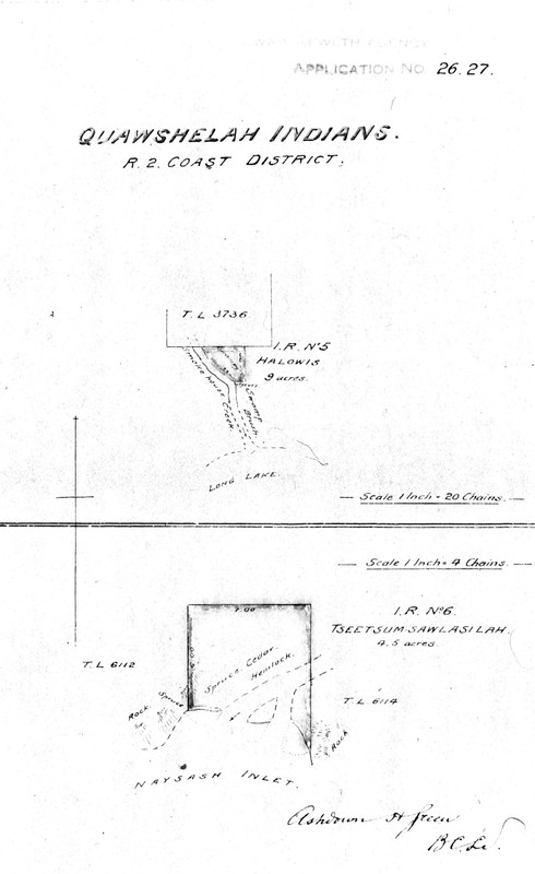
Quawshelah Indians. R. 2, Coast District. [Map showing Halowis Reserve No. 5 and Tseetsum-Sawlasilah Reserve No. 6./Carte montrant la réserve Halowis no 5 et la réserve Tseetsum-Sawlasilah no 6.]
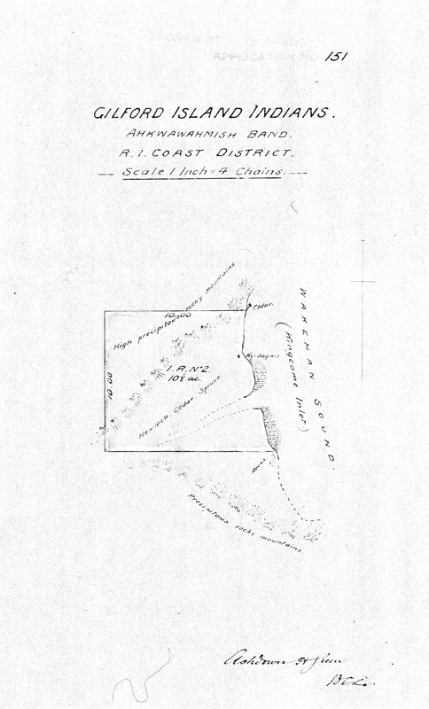
Gilford Island Indians. Ahkwawahmish band. R. 1, Coast District. [Map showing Kyidagwis Reserve No. 2/Carte montrant la réserve Kyidagwis no 2.]
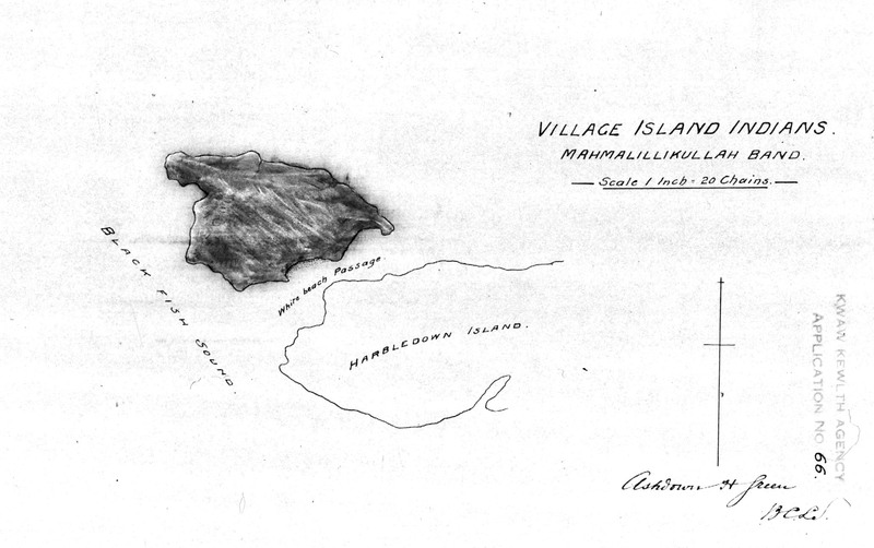
Village Island Indians, Mahmalillikullah band. [Map showing Compton Island Reserve No. 6./Carte montrant la réserve Compton Island no 6. ]
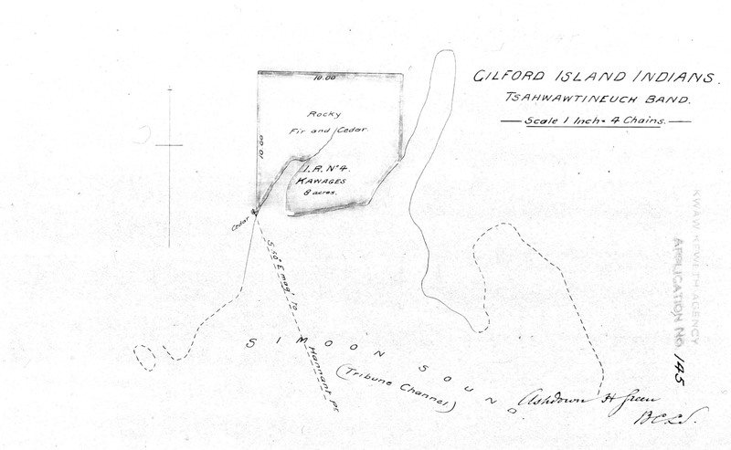
Gilford Island Indians. Tsahwawtineuch band. [Map showing Kawages Reserve No. 4./Carte montrant la réserve Kawages no 4.]
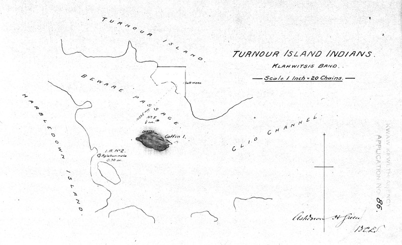
Turnour Island Indians, Klahwitsis band. [Map showing Reserves No. 1, 2, 3 and 5./Carte montrant les réserves nos 1, 2, 3, et 5.]
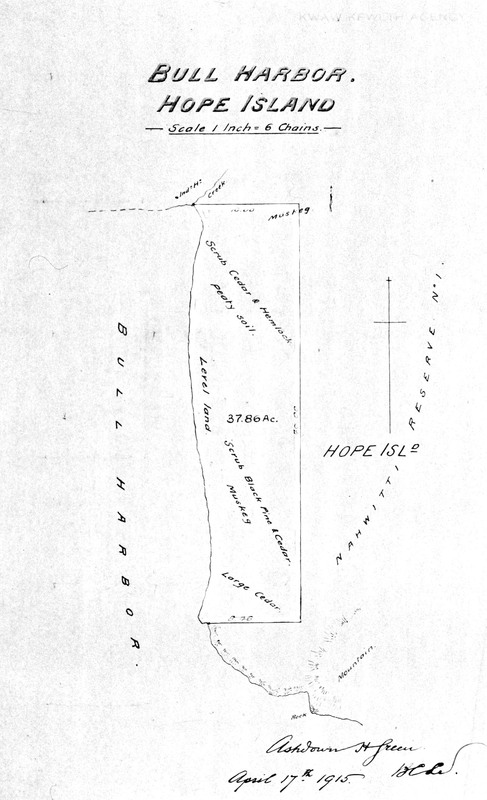
Bull Harbor. Hope Island. [Map showing part of Hope Island Reserve No. 1./Carte montrant une partie de la réserve Hope Island no 1.]
Cheslatta Indians. Fort Fraser District. [Map showing Chislatlate Reserve No. 9 and Cheslatta Lake Reserve No. 10./Carte montrant la réserve Chislatlate no 9 et la réserve Cheslatta Lake no 10.]
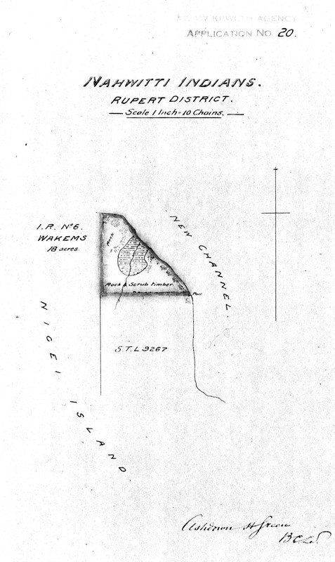
Nahwitti Indians. Rupert District. [Map showing Wakems Reserve No. 6./Carte montrant la réserve Wakems no 6.]
Gilford Island Indians. Tsahwawtineuch band. R. 1, Coast District. [Map showing Bat-l-ki Reserve No. 3./Carte montrant la réserve Bat-l-ki no 3.]
Kootenay Final Report Images/Kootenay Images du rapport final-Full Map
Showing 76 to 100 of 514 results
Page
of 21