Skip to main content
Advanced Search
Narratives
Background to the McKenna McBride Royal Commission
Impacts of the McKenna McBride Commission
Our Culture Lives in the Land
Testimonies
Maps/Photos
Final Report
Agency Reports
Additional Resources
My Account
My bookmarks
Register
Log in
About
For Teachers
For Researchers
About the Records
About the Project
Disclaimers and Copyright
FAQs
How to Use
Advanced Search
Our Homes Are Bleeding
Digital Collection
Return to Library & Archives
Items
View as:
Grid
List
Created
Resource class
Title
Contributed on (numeric:timestamp)
Created on (numeric:timestamp)
Date (numeric:integer)
Date (numeric:interval)
Date (numeric:timestamp)
Date Created (numeric:timestamp)
Date Modified (numeric:timestamp)
Ascending
Descending
Sort
Advanced search
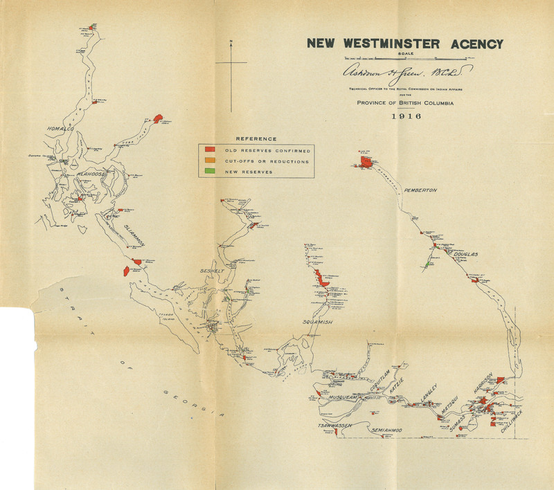
New Westminster Final Report Images/New Westminster Image du rapport final
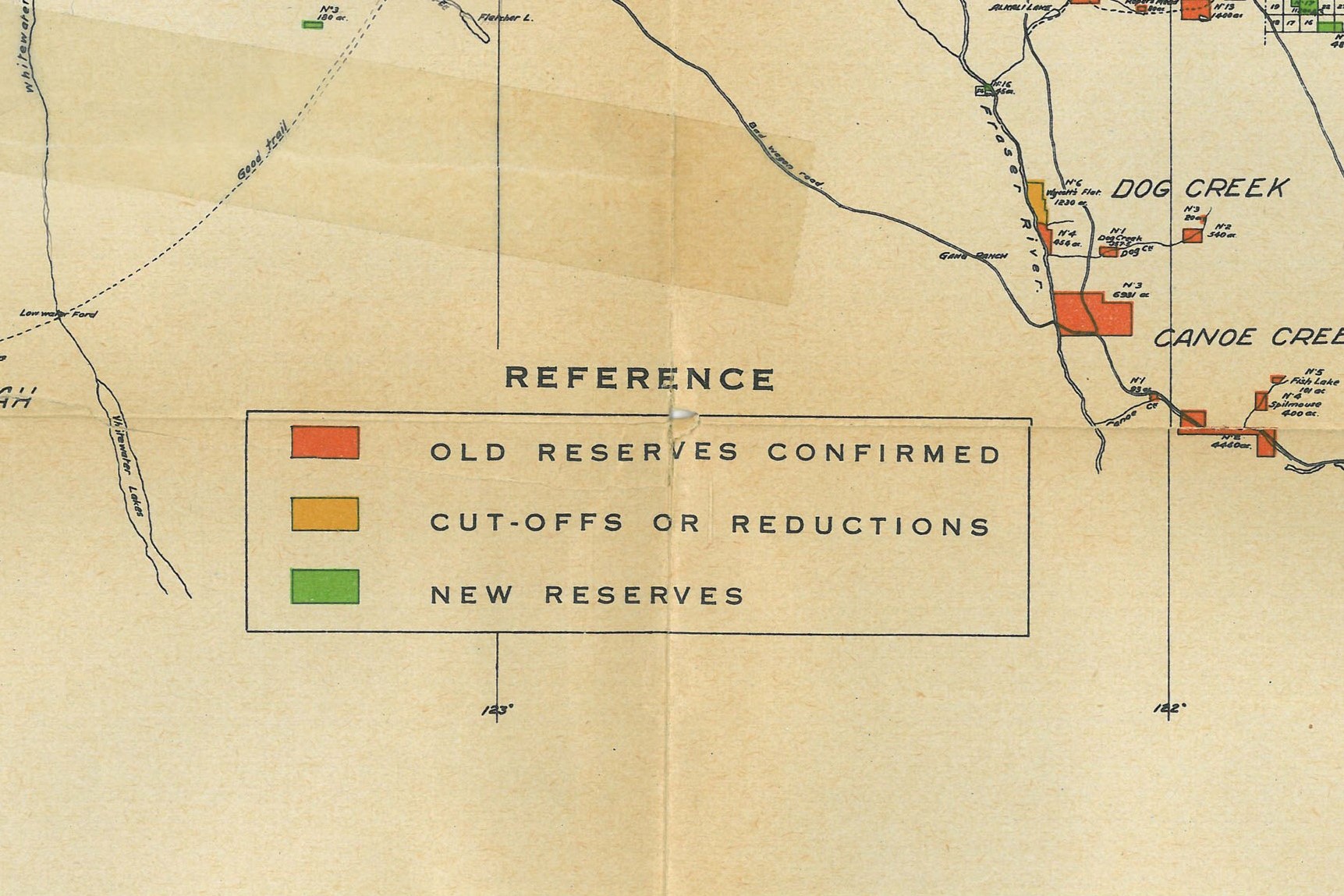
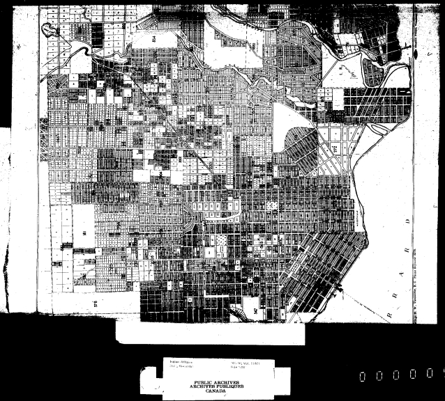
New Westminster Exhibits Map 4/New Westminster carte de'exposé 4
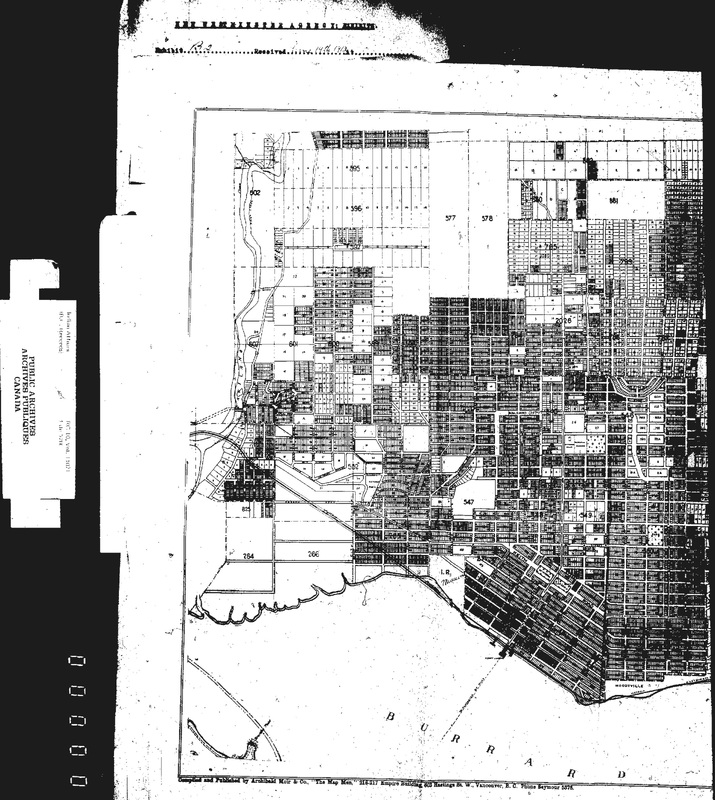
New Westminster Exhibits Map 3/New Westminster carte de'exposé 3
New Westminster Exhibits Map 2/New Westminster carte de'exposé 2
New Westminster Exhibits Map 1/New Westminster carte de'exposé 1
Seshelt Indians. New Westminster District. [Map showing Egmont Reserve No. 26./Carte montrant la réserve Egmont no 26.]
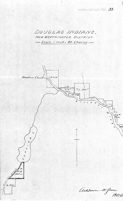
Douglas Indians. New Westminster District. [Map showing Reserves No. 4, 4A, 5, 5A, 5B, 9 and 12./Carte montrant les réserves nos 4, 4A, 5, 5A, 5B, 9 et 12.]
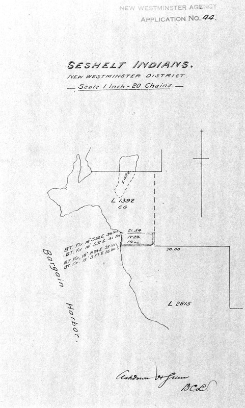
Seshelt Indians. New Westminster District. [Map showing Bargain Harbour Reserve No. 24./Carte montrant la réserve Bargain Harbour no 24.
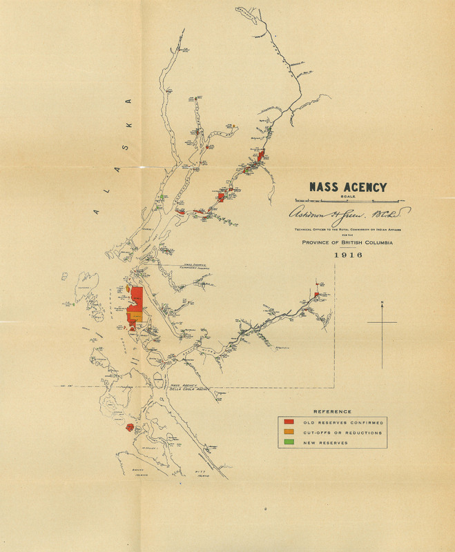
Nass Final Report Images/Nass Images du rapport final - Full Agency Map/Image complète du carte
Nass Exhibits Map 1/ Nass carte de l'exposé
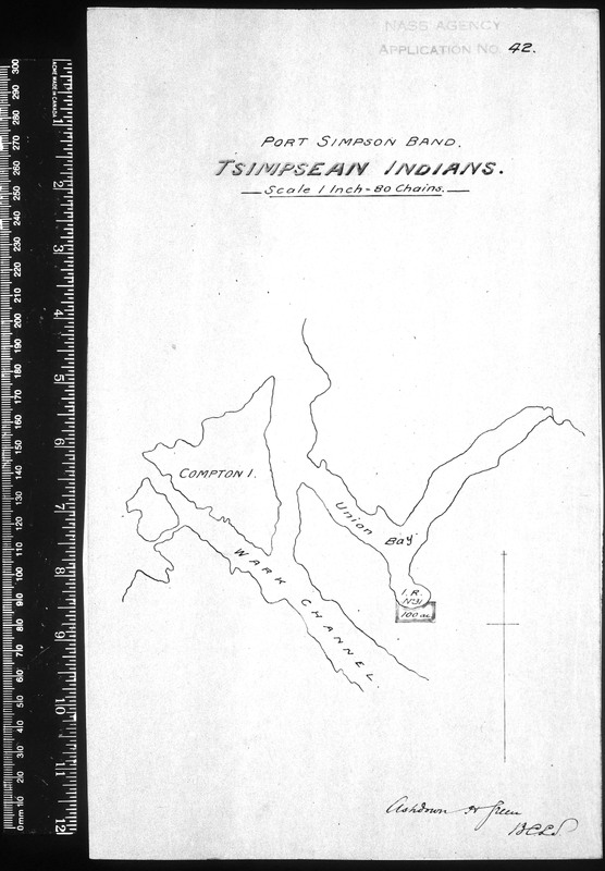
Port Simpson band. Tsimpsean Indians. [Map showing Union Bay Reserve No. 31./Carte montrant la réserve Union Bay no 31.]
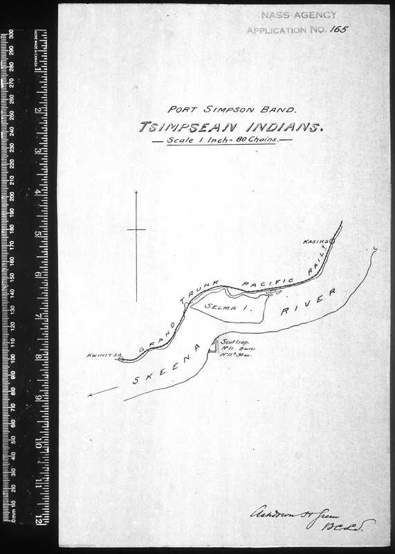
Port Simpson band. Tsimpsean Indians. [Map showing Scuttsap Reserves No. 11 and 11A./Carte montrant les réserves Scuttsap nos 11 et 11A.]
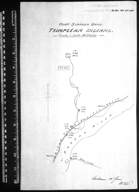
Port Simpson band. Tsimpsean Indians. [Map showing Reserves No. 26, 29, 70, 71 and 72./Carte montrant les réserves nos 26, 29, 70, 71, et 72.]
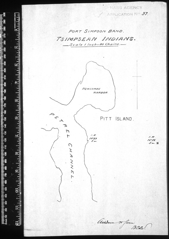
Port Simpson band. Tsimpsean Indians. [Map showing Pitt Island Reserve No. 27 and Ketai Reserve No. 28./Carte montrant la réserve Pitt Island no 27 et la réserve Ketai no 28.]
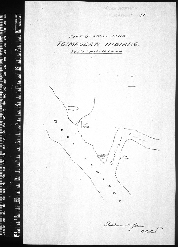
Port Simpson band. Tsimpsean Indians. [Map showing Reserves No. 13, 14 and 35./Carte montrant les réserves nos 13, 14 et 35.]
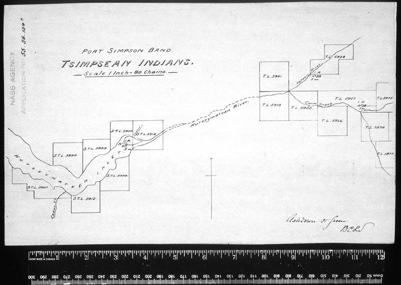
Port Simpson band. Tsimpsean Indians. [Map showing Reserves No. 38, 39 and 49./Carte montrant les réserves nos 38, 39 et 49.]
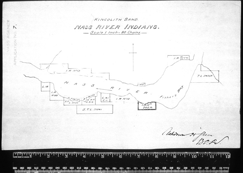
Nass River Indians. [Map showing Reserves No. 10, 11, 12, 12A, 13 and 88./Carte montrant les réserves nos 10, 11, 12, 12A, 13 et 88.]
Metlakatla band. Tsimpsean Indians. [Map showing Edye Reserve No. 93./Carte montrant la réserve Edye no 93. ]
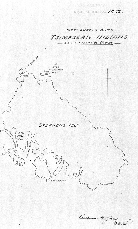
Metlakatla band. Tsimpsean Indians. [Map showing Squaderee Reserve No. 91 and Avery Island Reserve No. 92./Carte montrant la réserve Squaderee no 91 et la réserve Avery Island no 92.]
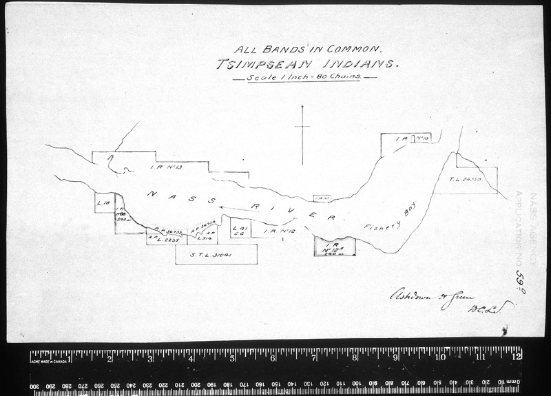
All bands in common. Tsimpsean Indians. [Map showing Reserves No. 10, 11, 12, 12A, 13 and 88./Carte montrant les réserves nos 10, 11, 12, 12A, 13 et 88]
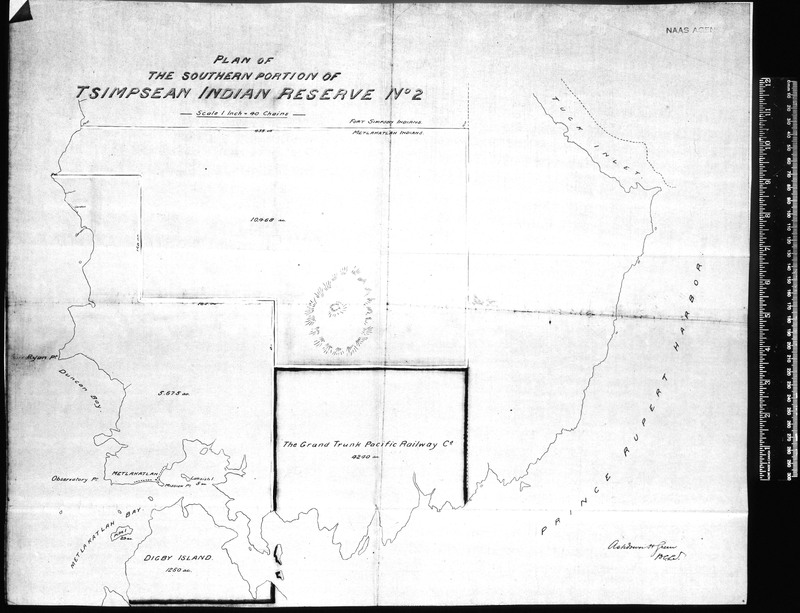
Plan of the southern portion of Tsimpsean Indian Reserve No. 2.
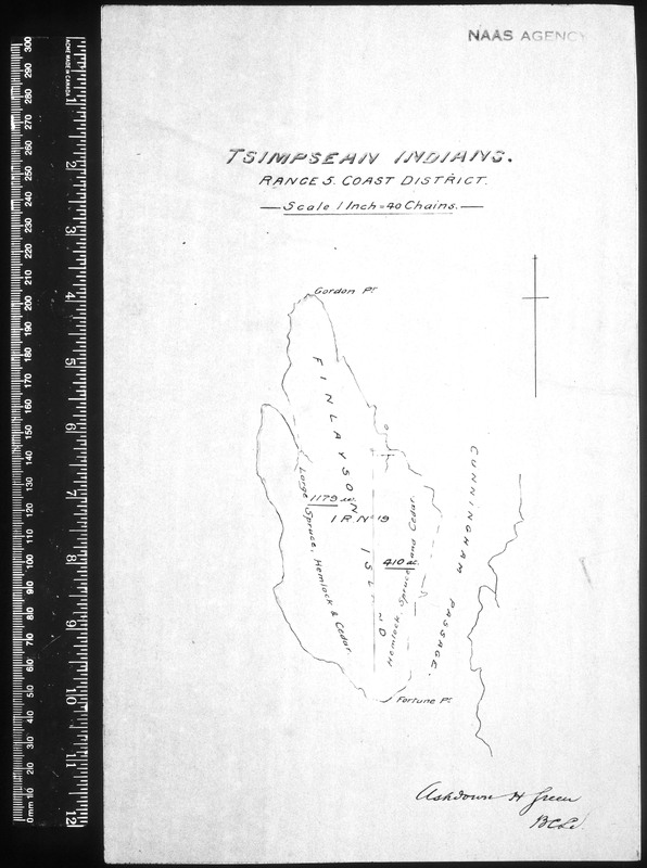
Tsimpsean Indians. Range 5, Coast District. [Map showing Finlayson Island Reserve No. 19./Carte montrant la réserve Finlayson Island no 19.]
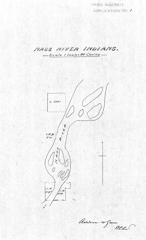
Nass River Indians. [Map showing Reserves No. 8, 8A and 31./Carte montrant les réserves nos 8, 8A et 31.]
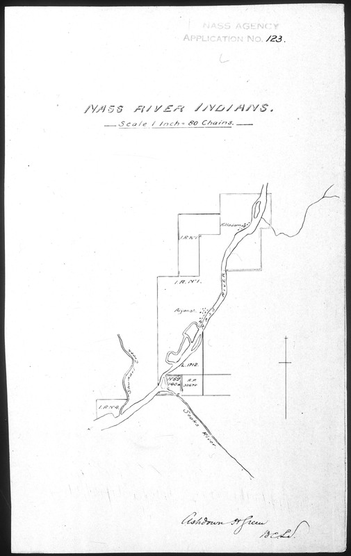
Nass River Indians. [Map showing Reserves No. 1, 1A, 4 and 89./Carte montrant les réserves nos. 1, 1A, 4 et 89.]
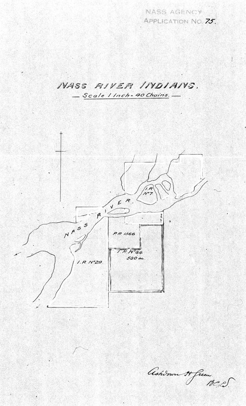
Nass River Indians. [Map showing Reserves No. 7, 29 and 44./Carte montrant les réserves nos 7, 29 et 44.]
Showing 51 to 75 of 514 results
Page
of 21